UK weather: warnings for rain and snow lasting until next week
UK weather: warnings for rain and snow lasting until next week
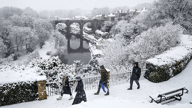
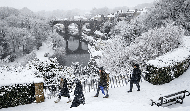
Large swathes of the UK are expected to experience biting cold weather over the next few days, with heavy snowfall and rain that can last for a month in parts of England and Scotland.
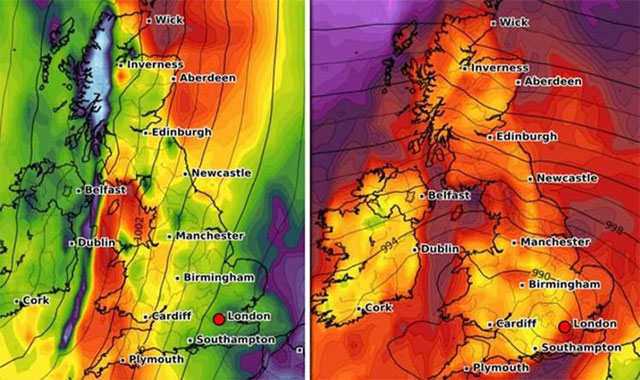
From Thursday and Monday, temperatures could drop by about 10C to just above freezing across large parts of England.
Yet it may feel as cold as -5C across some areas of the UK from Sunday, with a band of cold air forecast to move in from the East, remaining in place for the early part of next week and keeping temperatures hovering around freezing.
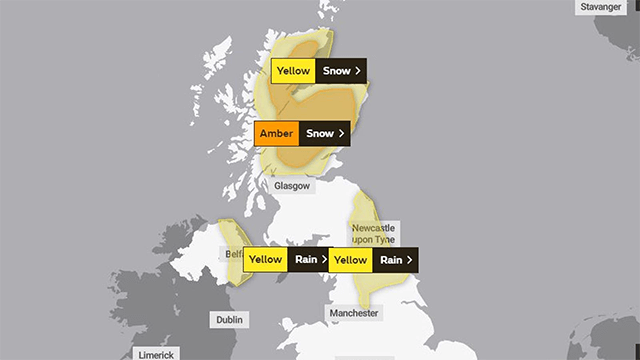
Friday's weather warnings. Pic: Met Office
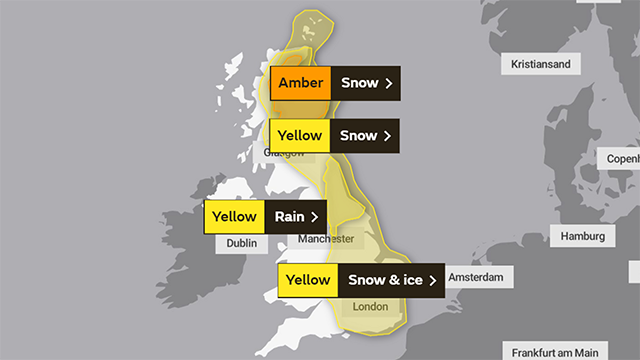
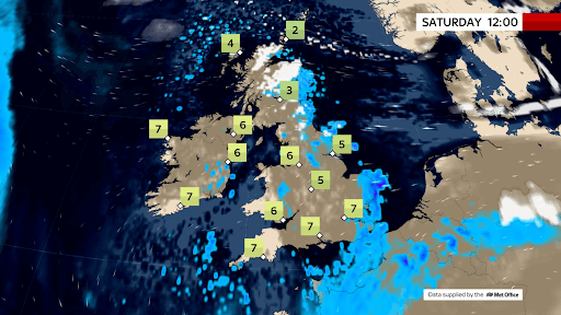
Saturday's weather warnings. Pic: Met Office
The Met Office sent warnings of snow to parts of Scotland, along with rainfall warnings for the North East of England and Northern Ireland.
A more severe amber snow warning is also in place for much of Scotland until 6 am on Saturday, with forecasters predicting as much as 50cm snowfall in the highest areas between now and tomorrow evening.
Furthermore, there are also yellow warnings for snow, ice, and rain in the East of England and Scotland on Saturday.
On Sunday, snow and ice are warned across much of Scotland and the east coast of England down as far as parts of the southern coast into Monday.
Up to 80mm of rain is expected to have fallen in isolated parts of the North East of England between Tuesday evening and Saturday lunchtime - almost one-and-a-half times the volume usually expected in the region during the whole month of February.
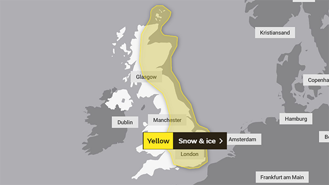
Sunday's weather warnings. Pic: Met Office
Met Office spokeswoman Nicola Maxey said that They could see a drop of about 10C in widely expected daytime temperatures going into the weekend and next week.
According to Sky's weather producer Joanna Robinson, the cold air currently across Scotland will create further snow there over the next few days. The Met Office has sent an amber snow warning for areas north of the Central Belt, where up to half a meter of snow is possible on the hills by Saturday.
She adds that it just is on top of the snow seen in recent days, with depths reported to be around 40cm in Braemar and Crathie already. This is likely to be a significant and disruptive snow event for the Grampians, with blizzards and drifting snow.
Over the weekend, the cold air covers most of the UK along with a raw easterly wind developing.
"Snow showers will shift to off the North Sea and then influence eastern parts, however, more disruptive snow is able to occur in East Anglia and the South East on Saturday night and Sunday.
It is predicted that the cold conditions will continue early next week, with further snow showers in the east. It will feel bitterly cold in the wind.
See also:
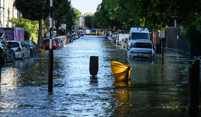
In accordance with the Environment Agency, there currently has 38 of its second-most-severe flood warnings in place, along sections of the river including the Thames, the Severn, and the Ouse, meaning flooding is expected.
Also, there are 133 less-severe flood alerts in place, across almost every region of England, meaning flooding is possible.
>>> For updated weather information, stay tuned for GoWeather!


0 Comments
Leave a Comment
Your email address will not be published. Required fields are marked *