US Weather: Another round of snow to end the week
The latest Storm Tracker Forecast from Meteorologist Jill Szwed.
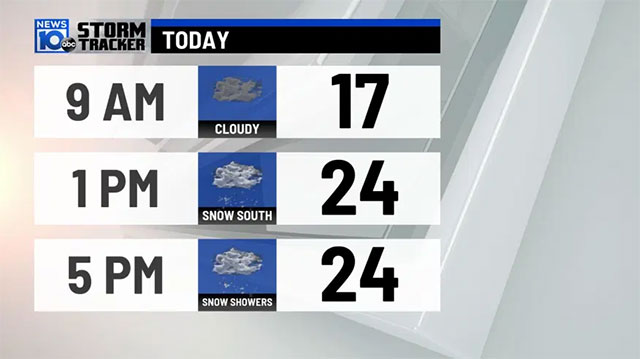
According to Jill Szwed, another round of snow is expected to come at the end of the week. On 02/18/ 2021, some light signs return but the snow is not making it to the ground just yet. Moreover, there is still a lot of dry air on the surface.
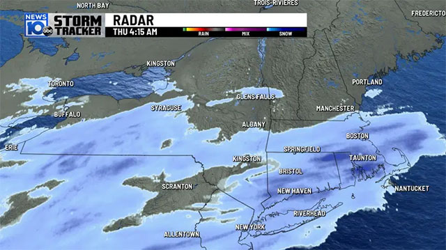
Last afternoon, a storm came out of the Gulf and then started to spread light snow across areas south of the Capital Region. The snow shifts slowly northward. In Albany, the first flakes were not seen until late-day. Widespread snow will fall overnight.
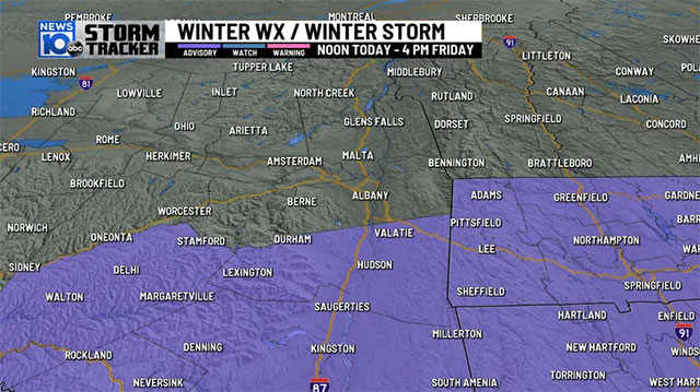
The highest snow accumulations will be south of Albany. After that, winter weather advice will be necessary at noon for Columbia, Greene, and Berkshire counties. Heavily falling, the snow could make the roads slick for this evening’s commute and again tomorrow morning.
See also:
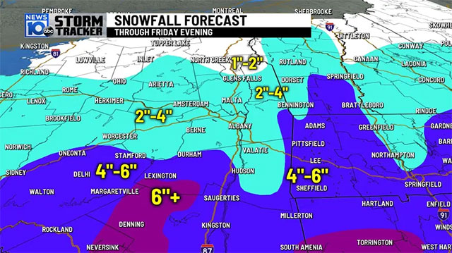
It is forecasted that the storm will move far from the coast a bit and then weaken as it approaches the Northeast. In the south of Albany, it is possible to experience several inches of snow, up to half a foot. Otherwise, the Capital Region, the Mohawk Valley, and parts of southern Vermont are going to see between two and four inches of fresh snow. Farther to the north is predicted to see even less snow.
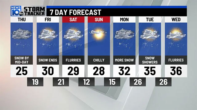
For Friday night, this round of snow will gradually taper off. We will be left with lingering flurries to begin the weekend.
From the weather forecast picture, it can be seen that the latest 7 Day Forecast is looking very snowy. There is a bright spot in the middle of the next seven days. Especially, Sunday will bring a quick glimpse at the sun. Next week will bring more rounds of snow.
For updated weather information, stay tuned for GoWeather.
![10 Health & Safety Precautions During Rainy Season [Be Careful]](https://admin.goweatherforecast.com/images/1732692097.png)



0 Comments
Leave a Comment
Your email address will not be published. Required fields are marked *